File:Map of Assyria.png
Jump to navigation
Jump to search
Size of this preview: 800 × 550 pixels. Other resolution: 1,983 × 1,363 pixels.
Original file (1,983 × 1,363 pixels, file size: 160 KB, MIME type: image/png)
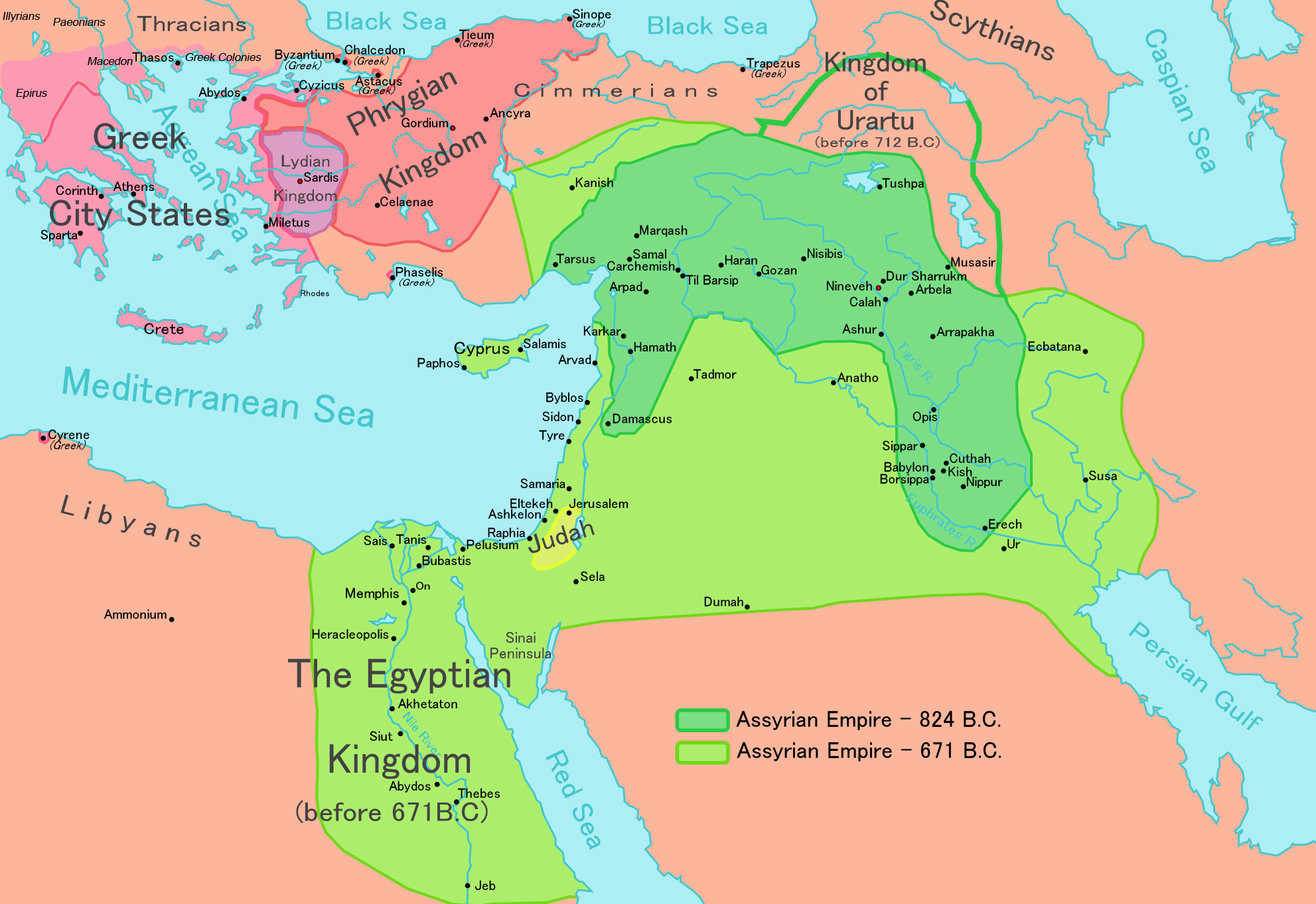
Summary
- Description
- English: Map of the Assyrian Empire
- Español : Extensión del Imperio Asirio
- Polski: Mapa Asyrii w 824 i 671 r. p.n.e.
- Português : Extensão do Império Assírio
- العربية : خارطة الإمبراطوريَّة الآشوريَّة.
- فارسی : نقشه امپراتوری آشور
- Date
- 26 February 2006
- Source
- Own work data from
- Based on a map in 'Atlas of the Bible Lands', C S Hammond & Co (1959), ISBN 9780843709414.
- Author
- Ningyou
- Source
- https://commons.wikimedia.org/wiki/File:Map_of_Assyria.png
File history
Click on a date/time to view the file as it appeared at that time.
| Date/Time | Thumbnail | Dimensions | User | Comment | |
|---|---|---|---|---|---|
| current | 19:24, 10 January 2021 | | 1,983 × 1,363 (160 KB) | Seanmcox (talk | contribs) | ;Description :English: Map of the Assyrian Empire :Español : Extensión del Imperio Asirio :Polski: Mapa Asyrii w 824 i 671 r. p.n.e. :Português : Extensão do Império Assírio :العربية : خارطة الإمبراطوريَّة الآشوريَّة. :فارسی : نقشه امپراتوری آشور ;Date:26 February 2006 ;Source :Own work data from :Based on a map in 'Atlas of the Bible Lands', C S Hammond & Co (1959), ISBN 9780843709414. ;Author:Ningyou ;Source:https://commons.wikimedia.org/wiki/File:Map_of_Assyria.png |
You cannot overwrite this file.
File usage
The following page uses this file: